
+ SCREEN Capture: show your customers no line of sight issues, save it to the sd card or email it to back office.
+ Works with all geostationary satellites
+ Works everywhere around the world
+ No Internet access needed to operate it (occasionally it is required)
+ Add, edit and delete satellites
+ Select favorite satellites
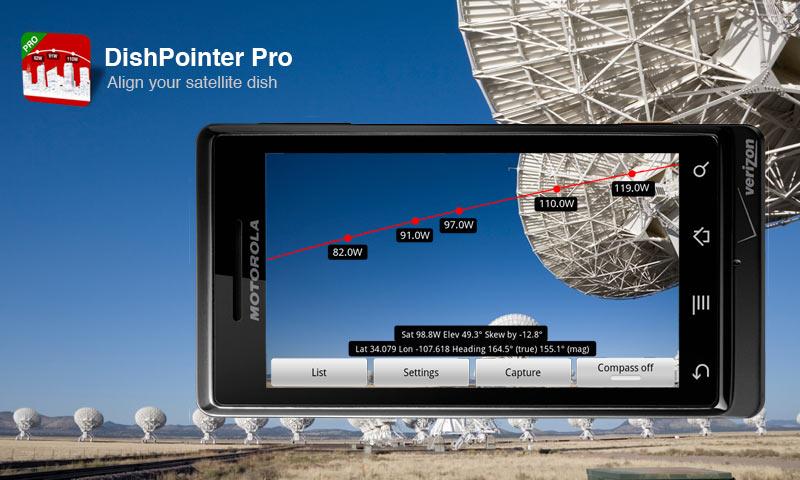
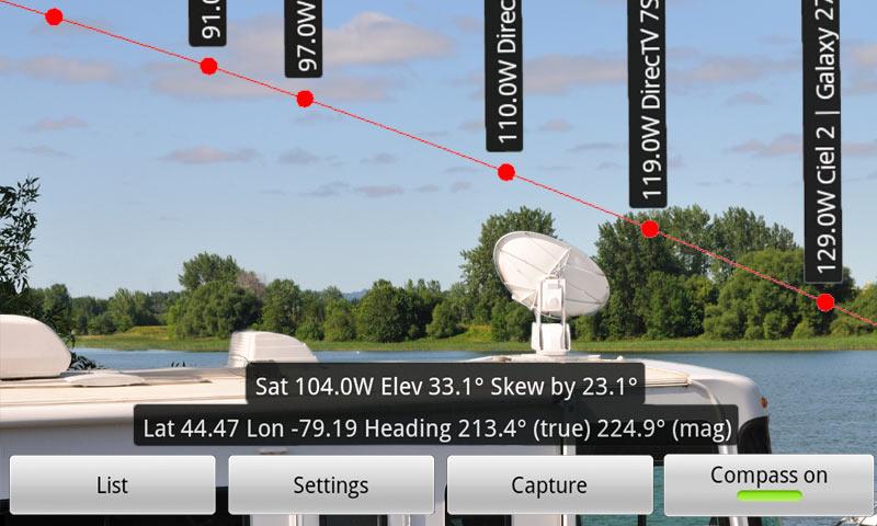
+ Azimuth, elevation and skew results